
파일:Large Low Pressure System Northeastern Pacific.JPG
미리 보기 크기: 800 × 532 픽셀 다른 해상도: 320 × 213 픽셀 | 640 × 426 픽셀 | 1,024 × 681 픽셀 | 1,280 × 852 픽셀 | 2,560 × 1,703 픽셀 | 4,256 × 2,832 픽셀
원본 파일 (4,256 × 2,832 픽셀, 파일 크기: 1.35 MB, MIME 종류: image/jpeg)
파일 설명
| 설명 |
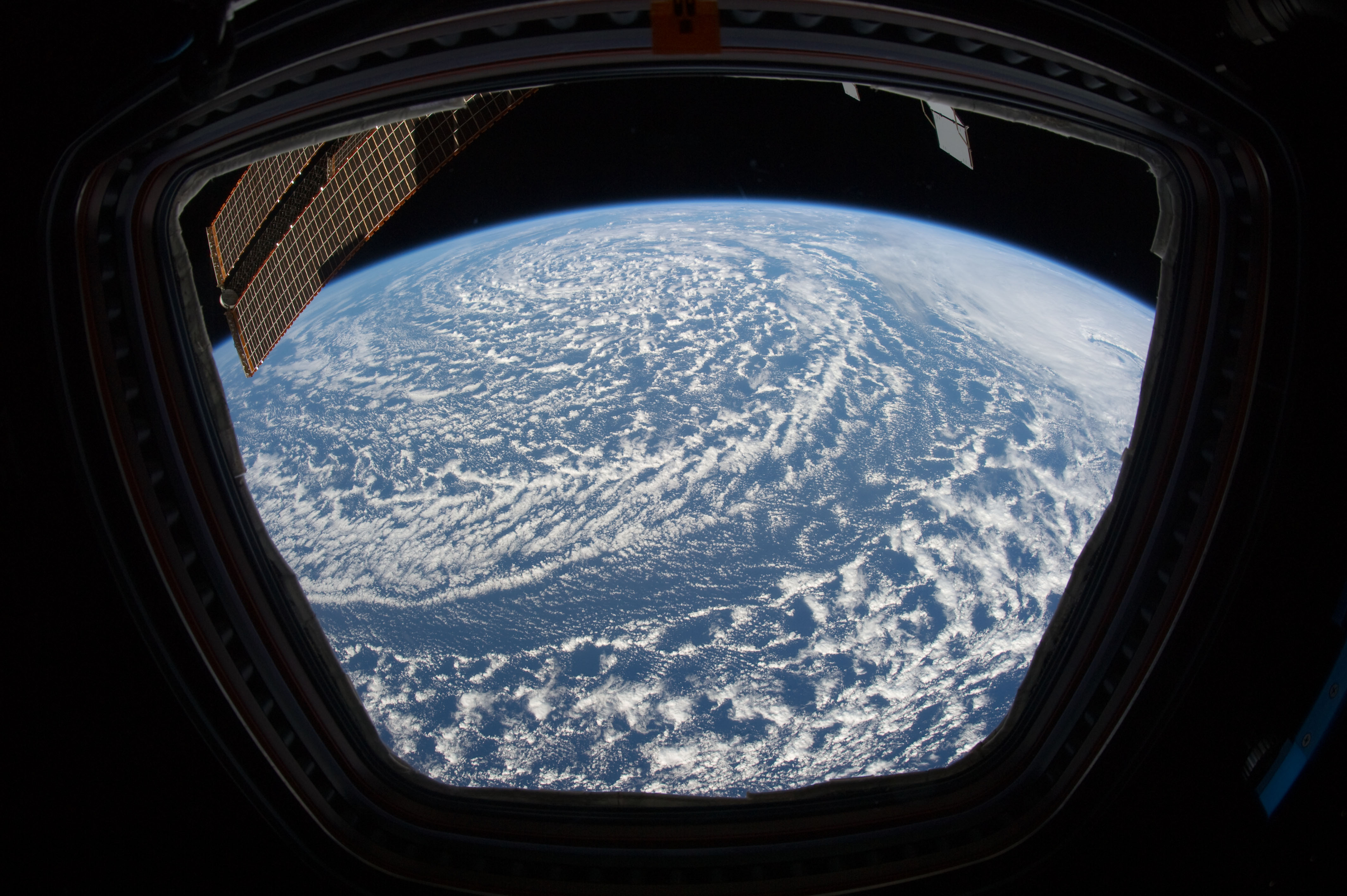
English: The diffuse cloud pattern in this image indicates an old, dissipating low pressure system. |
| 날짜 | |
| 출처 | NASA Earth Observatory |
| 저자 | ISS Expedition 27 crew |
| 다른 버전 |
|


| 카메라 위치 | | 이 지역의 다른 사진을 보기: 오픈스트리트맵 |
|---|
This image or video was catalogued by Johnson Space Center of the United States National Aeronautics and Space Administration (NASA) under Photo ID: ISS027-E-6500. This tag does not indicate the copyright status of the attached work. A normal copyright tag is still required. See Commons:Licensing. Other languages:
|
Image acquired with a Nikon D3S digital camera using a 16 mm lens, and is provided by the ISS Crew Earth Observations experiment and Image Science & Analysis Laboratory, Johnson Space Center.
라이선스
| 이 파일은 NASA에서 제작하였으므로 퍼블릭 도메인입니다. NASA의 저작권 정책에 따르면 NASA의 자료는 명시하지 않는 이상 저작권의 보호를 받지 않습니다. (Template:PD-USGov, 또는 NASA 저작권 정책 문서, JPL 그림 사용 정책을 참고하세요.) | ||
 |
주의사항:
|
파일 역사
날짜/시간 링크를 클릭하면 해당 시간의 파일을 볼 수 있습니다.
| 날짜/시간 | 섬네일 | 크기 | 사용자 | 설명 | |
|---|---|---|---|---|---|
| 현재 | 2011년 4월 4일 (월) 20:37 | | 4,256 × 2,832 (1.35 MB) | Originalwana | cropped |
| 2011년 4월 4일 (월) 20:14 |  | 4,256 × 2,913 (1.43 MB) | Originalwana | {{Information |Description ={{en|1=The diffuse cloud pattern in this image indicates an old, dissipating low pressure system.}} |Source =[http://earthobservatory.nasa.gov/IOTD/view.php?id=49958 NASA Earth Observatory] |Author =ISS Exped |
이 파일을 사용하는 문서
다음 문서 1개가 이 파일을 사용하고 있습니다:
이 파일을 사용하고 있는 모든 위키의 문서 목록
다음 위키에서 이 파일을 사용하고 있습니다:
- ar.wikipedia.org에서 이 파일을 사용하고 있는 문서 목록
- en.wikipedia.org에서 이 파일을 사용하고 있는 문서 목록
- sr.wikipedia.org에서 이 파일을 사용하고 있는 문서 목록